


The discipline of landscape photography has evolved from a pursuit of serendipity into a highly technical field where success is increasingly defined by the ability to predict and manipulate environmental variables. While the history of the medium is punctuated by iconic images captured by chance, the modern professional standard demands a level of intentionality that begins long before a shutter is released. This shift toward data-driven preparation is reshaping how photographers interact with the natural world, moving the focus from mere observation to a sophisticated synthesis of meteorology, cartography, and optical physics. At the heart of this evolution is the understanding that light is not merely a condition of the photograph but its primary subject, dictating the atmosphere, depth, and emotional resonance of the final image.
The foundational principle of modern landscape photography is that striking images are rarely the result of casual exploration. Consistent excellence requires a harmonious alignment of location, timing, equipment, and meteorological conditions. Professional photographers now employ a rigorous workflow that treats a photoshoot as a strategic operation. This process begins with the setting of creative intent—deciding whether a scene should communicate drama, intimacy, or stillness—and follows a structured path through digital scouting and environmental analysis.
The Chronology of a Planned Landscape Shoot
A professional landscape photography project typically follows a specific chronological progression, moving from abstract concepts to physical execution. The first phase involves thematic formulation, where the photographer identifies a specific mood or message. This is often supported by the creation of mood boards using platforms such as Pinterest, Figma, or LibreOffice Impress. By aggregating visual references, photographers can solidify their vision and identify the specific lighting conditions—such as high-contrast storm light or soft, low-contrast fog—required to achieve their goal.
The second phase is digital reconnaissance. Tools like Google Earth Pro have revolutionized this stage, allowing for 3D aerial views and street-level assessments of remote locations. Photographers use these platforms to record GPS coordinates and identify potential vantage points. This is supplemented by research on social platforms like Flickr and 500px, which provide a historical record of how a location has been photographed previously. This data allows the professional to either replicate successful compositions for educational purposes or, more importantly, identify "visual gaps"—angles and conditions that have not yet been exploited—to create unique work.
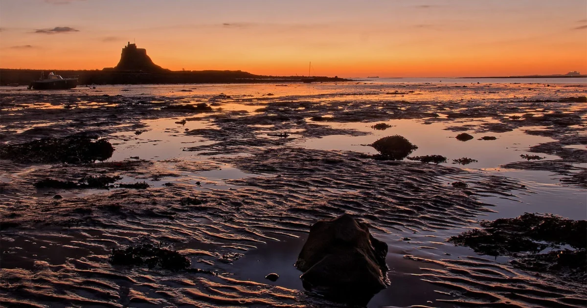
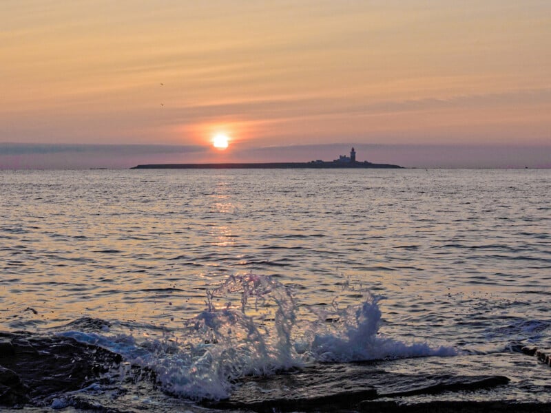
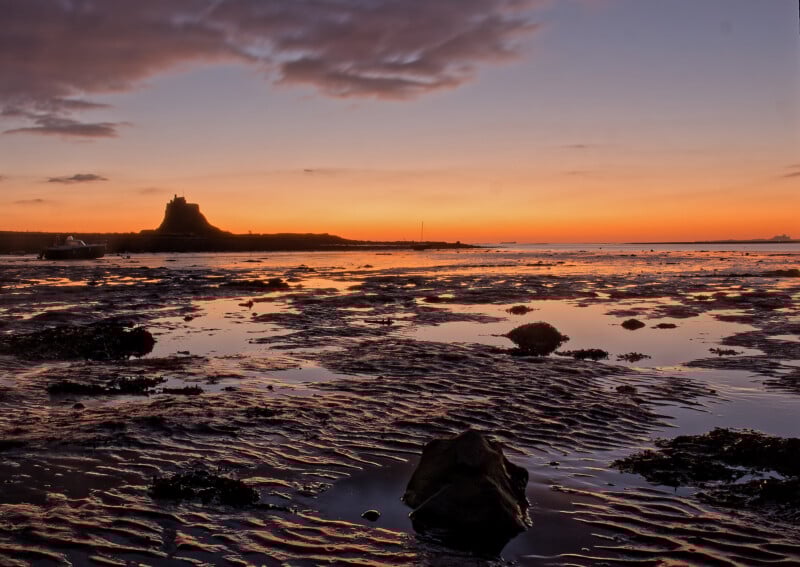
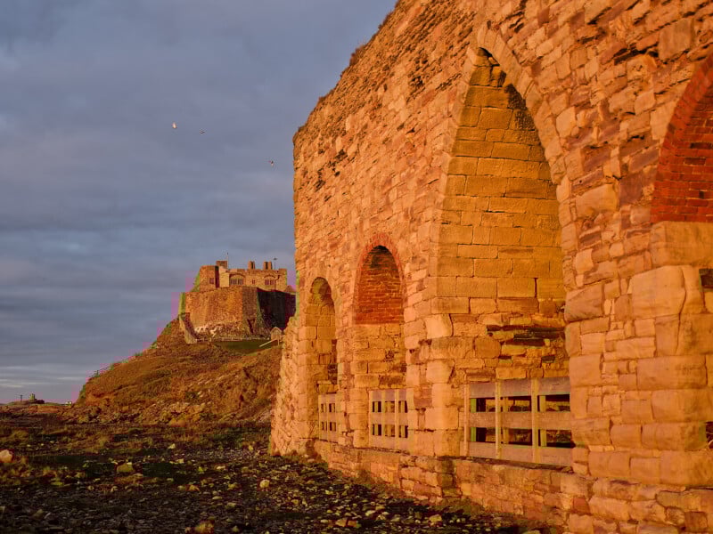
The third phase is ground-truthing or physical scouting. This is a critical step to account for temporary environmental changes that satellite imagery cannot capture. A prominent example in the industry involves Lindisfarne Castle in Northumberland. In recent years, numerous photographers traveled to the site during peak seasonal windows only to find the 16th-century structure encased in scaffolding for extensive renovations. Physical scouting also serves a vital safety function, identifying hazards such as unstable cliffs, tidal traps, or aggressive livestock that could jeopardize the photographer or their equipment.
The final phase is the execution window, which is dictated entirely by short-term meteorological forecasts and astronomical data. This phase relies on specialized software to identify the precise minute the sun or moon will interact with specific topographical features.
Technological Integration: PhotoPills and the Emergence of Earth.gl
The democratization of high-end landscape photography has been accelerated by a suite of specialized applications designed to remove the guesswork from environmental planning. For years, PhotoPills has served as the industry standard, offering modules for calculating the hyperfocal distance and tracking the celestial paths of the sun, moon, and Milky Way. Its Depth of Field (DoF) calculator is essential for photographers seeking to maintain sharp focus from the immediate foreground to the distant horizon, a hallmark of the "grand landscape" style.
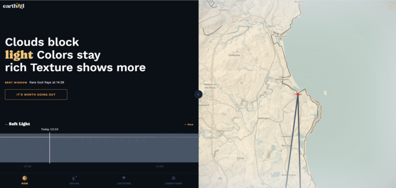
However, a new entrant in the field, Earth.gl, is gaining traction by offering a more integrated user interface that combines lighting predictions with real-time ecological data. Unlike traditional weather apps, Earth.gl is tailored specifically for the visual arts. It provides analysis on "light quality," describing how cloud cover will act as a natural softbox to saturate colors or when a "halo light" effect might occur.
Furthermore, Earth.gl incorporates biodiversity data, listing sightings of specific bird species, mammals, and insects. This multi-layered approach reflects a broader trend in the industry where landscape photography is overlapping with conservation and wildlife photography. The ability to see wind direction and cloud height in a single interface allows photographers to plan long-exposure shots where moving clouds create a sense of ethereal motion, leading the viewer’s eye through the frame.
The Physics of Light and Seasonal Variability
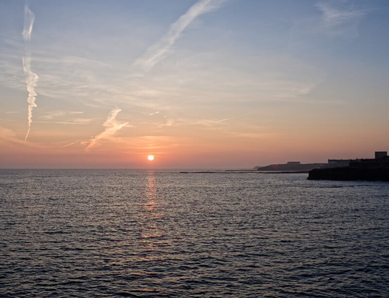
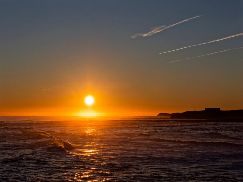
The scientific basis for planning revolves around the physics of light, specifically how it interacts with the Earth’s atmosphere. The "Golden Hour"—the period shortly after sunrise or before sunset—is prized because the sun’s low angle forces light to pass through a thicker layer of the atmosphere. This results in Rayleigh scattering, which filters out shorter blue wavelengths and leaves the warm reds and oranges that photographers covet.
Seasonality adds another layer of complexity. The sun’s path across the sky shifts significantly between the summer and winter solstices. A composition that works perfectly in June, with light hitting a particular cliff face, may be shrouded in shadow by December. Advanced planning tools allow photographers to "time travel" digitally, viewing the sun’s position for any date in the future. This allows for the scheduling of shoots months in advance to ensure the light aligns perfectly with the intended composition.
Implications for the Industry and Creative Authenticity
The rise of precision planning has significant implications for the photography industry. On one hand, it has raised the bar for technical quality; images that would have been once-in-a-lifetime captures are now achievable for any dedicated amateur with the right software. On the other hand, it has led to the "cliché trap," where popular locations become over-saturated with nearly identical images taken under the same "perfect" conditions.
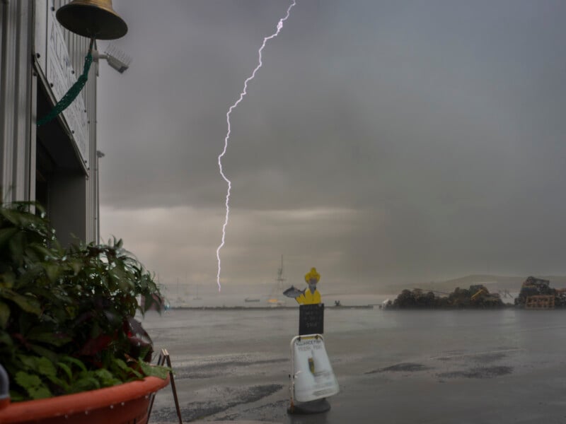
Industry analysts suggest that the next frontier in landscape photography will not be better gear, but better interpretation of data. The most successful photographers are those who use planning tools to find "atypical" beauty—capturing a well-known landmark in a rare lightning storm or during a specific tidal event that occurs only once every few years.
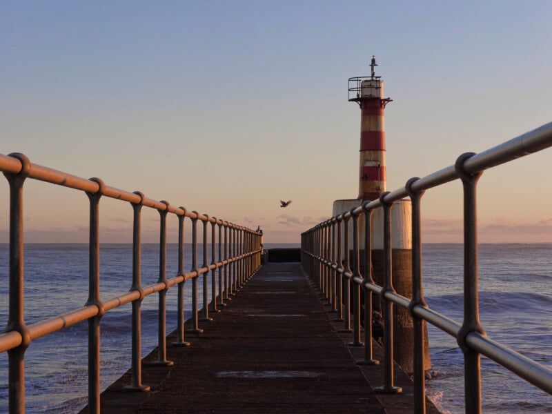
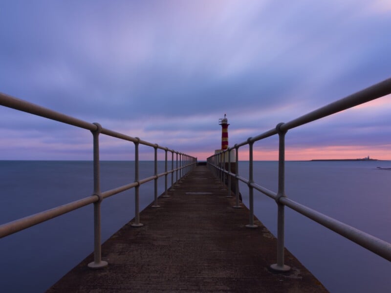
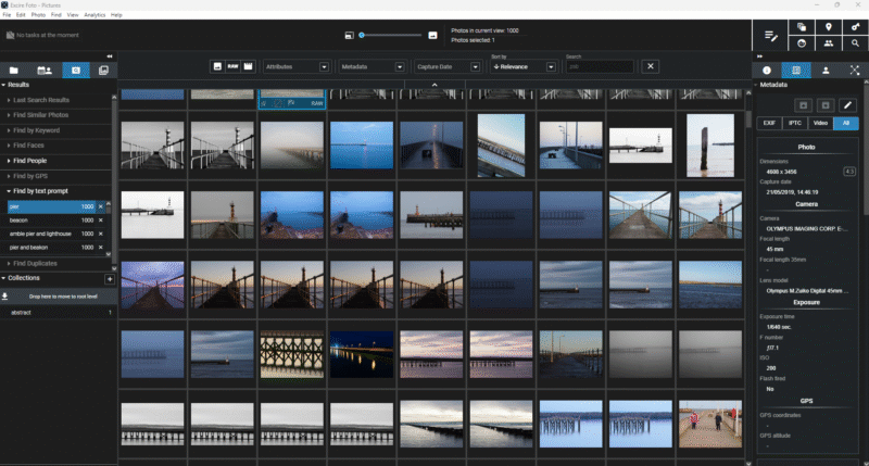
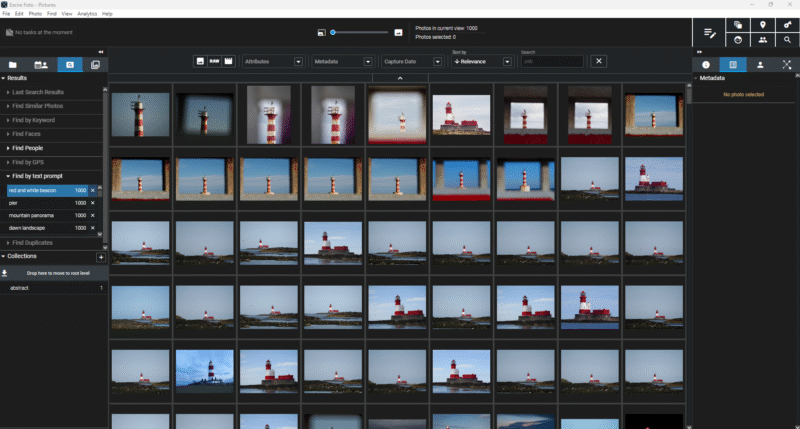
Furthermore, the integration of AI-driven image management tools like Excire is changing how photographers utilize their own archives for planning. By using AI to search through thousands of their own past images for specific features—such as "red and white beacon" or "pier at sunrise"—photographers can perform a meta-analysis of their own style and progress, identifying patterns in their work that can be refined in future shoots.
Environmental Stewardship and Safety
As planning becomes more precise, it also places a greater emphasis on environmental stewardship. The ability to pinpoint the exact location of a rare flower or a fragile rock formation can lead to over-tourism and habitat degradation. Professional organizations are increasingly advocating for "Leave No Trace" principles to be integrated into the planning phase.
Safety remains the most pragmatic reason for meticulous preparation. Coastal photography, in particular, is fraught with risk. Understanding tide tables is not just a matter of getting the right shot of a reflection in a tide pool; it is a matter of ensuring the photographer is not cut off from the mainland by a rising tide. The integration of high-resolution tidal data into apps like Earth.gl represents a significant safety advancement for the community.
Conclusion
The transition from the "snapshot" to the "constructed landscape" marks the maturity of photography as a technical art form. By treating the environment as a dynamic set of variables that can be studied and predicted, photographers are able to move beyond the limitations of luck. The synthesis of mood boards, digital scouting, meteorological analysis, and specialized software has created a framework where creative intent can be realized with surgical precision. In this new era, the most important piece of equipment in a photographer’s bag may not be the camera or the lens, but the data that tells them exactly when and where to stand. Through this rigorous preparation, the grandeur and subtlety of the natural world are not just captured, but are thoughtfully interpreted for the viewer.
