


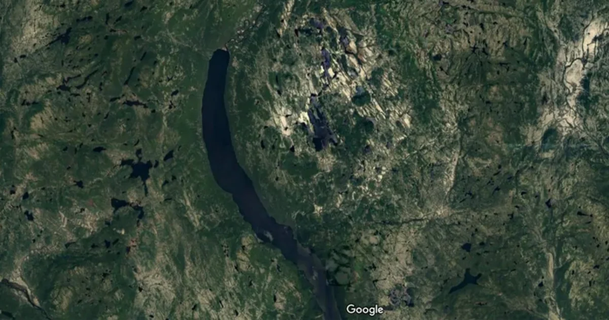
While planning a routine camping excursion through the remote Côte-Nord region of Quebec, Joël Lapointe, an amateur astronomer and outdoor enthusiast, encountered an unusual geological formation on Google Maps that would eventually lead to a major scientific breakthrough. What initially appeared to be a curious, circular pit nestled within the rugged Canadian landscape has now been tentatively confirmed by a team of geologists as a massive meteorite impact crater dating back approximately 390 million years. This discovery, spanning nearly 15 miles in diameter, represents one of the most significant terrestrial impact finds in recent years, highlighting the growing role of citizen science and satellite technology in the field of planetary geology.
The Genesis of a Geological Discovery
The discovery began not in the field, but on a computer screen. Joël Lapointe was utilizing Google Maps to scout potential campsites and hiking routes in the Côte-Nord region, a vast and sparsely populated area of eastern Quebec known for its dense forests and complex river systems. While scanning the topography, Lapointe noticed a strikingly symmetrical, spherical structure that seemed out of place among the surrounding glacial scars and mountainous terrain. Recognizing that such geometric regularity in nature often signals a significant geological event, he reached out to experts to share his findings.
Lapointe’s observation eventually reached Gordon Osinski, a professor of planetary geology at Western University and a leading expert in impact cratering. While Osinski receives dozens of inquiries annually from members of the public who believe they have found meteor sites, the vast majority—roughly 99 percent—are identified as natural volcanic formations, glacial depressions, or eroded hills. However, the satellite imagery of the Quebec site provided a compelling visual case that warranted a professional investigation. The circularity and the specific topographic "ring" structure were classic indicators of a complex impact crater.
An Arduous Expedition into the Canadian Wilderness
Confirming a meteorite impact requires more than just visual evidence from space; it necessitates physical samples and on-site geological mapping. In the summer of 2024, following Lapointe’s initial report, Osinski and a team of researchers organized an expedition to the site. The logistics of the journey underscored the remoteness of the find. The Côte-Nord terrain is notoriously difficult to navigate, characterized by thick underbrush, marshy lowlands, and a lack of established infrastructure.
Osinski, a veteran of over 25 expeditions to the Arctic and various remote sites across six continents, described the journey as one of the most grueling of his career. The team relied on a seaplane to reach the vicinity of the crater, but the density of the forest and the shallow nature of the local waterways meant the aircraft could not dock at the shore. Instead, the researchers were forced to disembark nearly 150 feet from land, wading through waist-deep water while carrying sensitive scientific equipment, camping gear, and supplies. Once ashore, they faced a relentless onslaught of insects and a landscape so rugged that every mile of progress required hours of physical exertion.
The Scientific "Smoking Gun": Shatter Cones and Impact Melt
The primary goal of the expedition was to find "shock metamorphism" evidence—physical changes in the rock that occur only under the extreme pressure and temperature of a celestial collision. On the second day of the field survey, the team discovered the definitive evidence they were looking for: shatter cones.
Shatter cones are rare geological features that form in the bedrock beneath meteorite impact craters or at the sites of underground nuclear explosions. They are characterized by distinct, fan-shaped patterns of grooves or striations that radiate from the point of impact. Because the pressures required to create shatter cones exceed those found in typical volcanic or tectonic processes, their presence is considered an irrefutable "smoking gun" for a bolide impact.
In addition to shatter cones, the team identified significant deposits of impact melt rock. When a large asteroid strikes the Earth at hypersonic speeds, its kinetic energy is instantaneously converted into heat, reaching temperatures high enough to melt tens of cubic kilometers of the Earth’s crust. This molten rock then cools and solidifies into unique glass-like or crystalline structures. Osinski noted that the examples found at the Quebec site were "spectacular," providing further data points to estimate the energy of the original impact.
Geochronology and the Devonian Context
Preliminary analysis of the site suggests the crater is approximately 390 million years old. This places the impact in the Devonian Period, a pivotal era in Earth’s history often referred to as the "Age of Fishes." During this time, the Earth’s landmasses were migrating toward the formation of the supercontinent Pangea, and the first seed-bearing plants and forests were beginning to transform the terrestrial landscape.
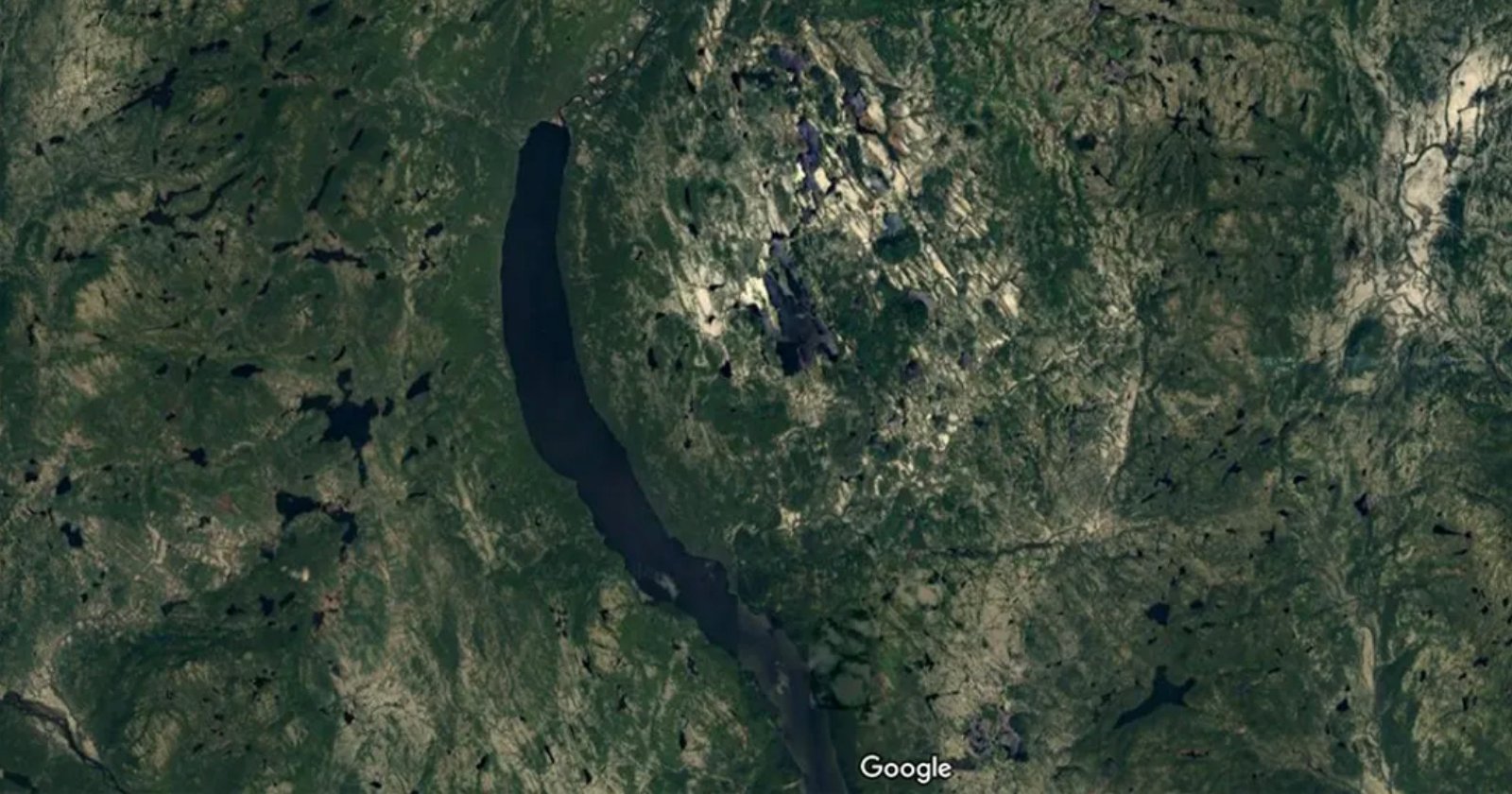
The size of the crater—approximately 15 miles (25 kilometers) wide—suggests that the asteroid responsible for the strike was substantial, likely measuring over a mile in diameter. An impact of this magnitude would have had devastating local and regional consequences, sending shockwaves through the crust and ejecting massive amounts of debris into the atmosphere. For scientists, dating the crater precisely is essential for understanding whether this impact correlates with any of the minor extinction pulses or climatic shifts recorded in the Devonian fossil record.
The Significance of the Find in a Global Context
The discovery of the Quebec crater is a rare event in the world of geology. Despite Earth’s 4.5-billion-year history, there are only about 200 confirmed meteorite impact craters identified globally. This scarcity is not due to a lack of impacts, but rather to the Earth’s dynamic nature. Unlike the Moon, which preserves a pristine record of every strike because it lacks an atmosphere and tectonic activity, the Earth actively erases its impact history through erosion, sedimentation, and plate tectonics.
Canada is home to a disproportionate number of these confirmed sites—31 in total—largely due to the presence of the Canadian Shield. This massive area of ancient, stable Precambrian rock acts as a "geological parchment," preserving the scars of ancient impacts better than the younger, more volatile crust found elsewhere. The United States, by comparison, has approximately 50 confirmed sites. The addition of a 15-mile-wide crater to the global registry is a major contribution to the map of Earth’s celestial encounters.
Reactions from the Scientific Community and the Discoverer
The success of the expedition has been met with enthusiasm from both the scientific community and Joël Lapointe himself. For Lapointe, the confirmation of his "suspicious pit" serves as a validation of curiosity and the power of modern mapping tools. He noted that it is a rare honor for an ordinary citizen to contribute to such a significant geological find. Lapointe has publicly encouraged others to trust their intuition when observing the natural world, suggesting that many more discoveries may be hiding in plain sight on digital platforms.
Professor Osinski emphasized that while the field of geology often relies on high-tech sensors and expensive aerial surveys, the human eye remains a powerful tool. The fact that a camping trip’s planning phase led to the discovery of a 390-million-year-old crater underscores the potential for collaboration between professional scientists and motivated amateurs.
Implications for Future Research and Planetary Defense
The confirmation of the Quebec crater opens a new chapter for regional geological research. The team plans to return to the site for more intensive sampling, aiming to use isotopic dating methods on the impact melt to narrow down the age of the strike with greater precision. They also hope to map the full extent of the "ejecta blanket"—the layer of debris thrown out of the crater—which can provide clues about the angle and velocity of the incoming asteroid.
Beyond historical interest, studying ancient craters like this one is vital for the field of planetary defense. By understanding the frequency and scale of past impacts, scientists can better model the risks posed by Near-Earth Objects (NEOs) today. Every confirmed crater provides a data point that helps calibrate the "impact flux"—the rate at which Earth is hit by objects of various sizes.
Furthermore, the discovery highlights the evolving utility of remote sensing. As satellite imagery becomes increasingly high-resolution and accessible to the public, the barrier to entry for archaeological and geological discovery continues to lower. The Quebec crater serves as a case study in how "digital prospecting" can lead to physical breakthroughs in some of the most inaccessible regions of the planet.
As researchers continue to analyze the samples brought back from the Côte-Nord wilderness, the 15-mile-wide scar in the Quebec earth stands as a silent monument to a violent moment in the deep past, finally brought to light by a man looking for a place to pitch a tent. The site is expected to become a point of significant interest for geologists worldwide, potentially serving as a training ground for future planetary missions and a reminder of Earth’s enduring connection to the broader cosmos.

