


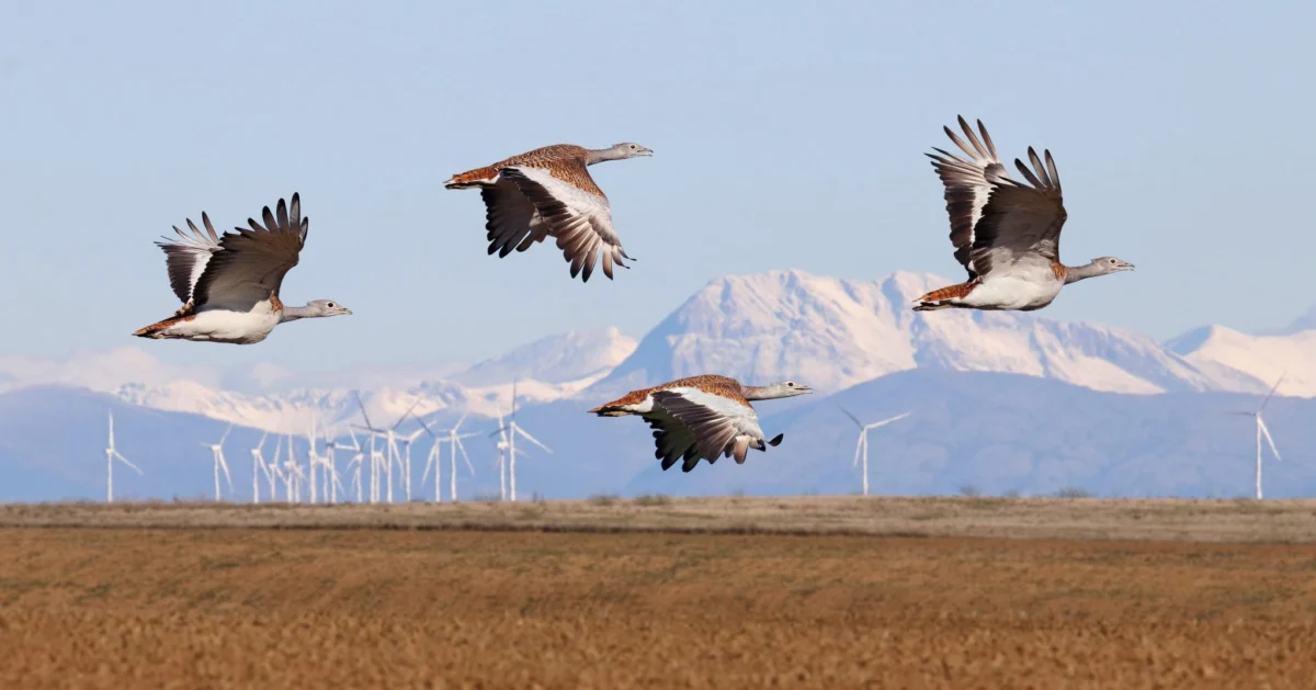
The urgent imperative to accelerate renewable energy deployment to avert ecological collapse is now facing a critical juncture, demanding a delicate balance with the imperative to safeguard wildlife. A growing consensus within the industry and governmental bodies is highlighting the strategic importance of siting renewable energy infrastructure, particularly wind turbines, in locations that minimize impacts on avian populations and other sensitive ecosystems. The most cost-effective and environmentally responsible approach to achieving this balance lies in meticulous spatial planning, identifying areas where impacts are negligible or more readily mitigated, thereby avoiding vulnerable species and critical migration routes altogether.
In this evolving landscape, sensitivity maps have emerged as indispensable tools, rapidly gaining traction across the renewable energy sector and among policymakers. Spearheading this vital development is BirdLife International, a global partnership of conservation organizations. Historically, the Avian Sensitivity Tool for Energy Planning (AVISTEP) was a pioneering effort, primarily focusing on identifying sensitive areas in Africa and Asia. Building on this foundational methodology, BirdLife’s European partners have adapted and refined AVISTEP, leveraging local data to create comprehensive national sensitivity maps. This localized approach ensures that the unique ecological characteristics and avian populations of each region are accurately represented, leading to more effective conservation strategies.
Across the European Union, a significant push is underway to designate dedicated Renewable Acceleration Areas (RAAs). These zones are intended to streamline the permitting process for renewable energy projects, both onshore and offshore, to meet ambitious climate targets. However, the effectiveness of these RAAs hinges on robust, science-based planning. Sensitivity maps are proving to be a cornerstone of this strategic spatial planning, providing crucial data to help Member States designate RAAs in locations that not only offer high renewable energy potential but also minimize detrimental impacts on biodiversity. The underlying principle is to integrate ecological considerations from the outset, rather than attempting to retrofit conservation measures after development plans are finalized.

Real-World Impact: Sensitivity Maps in Action Across Spain and Portugal
The tangible benefits of employing sensitivity maps are already evident in countries like Spain and Portugal, where dedicated conservation efforts have been instrumental in shaping renewable energy development. In Spain, the national partner SEO/BirdLife has been at the forefront of this initiative since the early days of wind energy development in Tarifa, located in the Strait of Gibraltar, during the 1990s. Historically, SEO/BirdLife has not shied away from legal challenges, initiating actions against projects proposed or constructed in ecologically sensitive areas that posed significant threats to vulnerable species.
By developing comprehensive avian sensitivity maps for both onshore and offshore wind and solar photovoltaic projects, SEO/BirdLife ensures that the crucial first step of the mitigation hierarchy—avoidance—is rigorously applied. These "game-changer" tools effectively guide developers away from critical habitats, safeguarding biodiversity before irreversible damage can occur. The maps, publicly available through their online platform, provide a clear, data-driven framework for responsible development, ensuring that the pursuit of renewable energy does not come at the expense of irreplaceable natural heritage. The visual representation of these maps, such as the example for mainland Spain’s onshore wind energy development, clearly delineates areas of high avian sensitivity, allowing for informed decision-making.
Across the border in Portugal, the partner SPEA (Sociedade Portuguesa para o Estudo das Aves) has demonstrated the profound influence that robust data can wield. Their development of offshore sensitivity maps, specifically focusing on 34 species impacted by collision and displacement from wind turbines, proved to be a significant factor in reshaping national energy planning. SPEA’s detailed analysis directly influenced an already finalized deployment plan for offshore wind farms. The data revealed areas of high avian sensitivity within locations initially identified by the government’s Marine Rapid Readiness Assessment. Consequently, the proposed site of Ericeira was removed from the development plans, and another area, Viana do Castelo, was significantly downsized.
This case underscores the adaptability and ongoing relevance of sensitivity maps. While ideally, these maps should guide the initial declaration of RAAs, SPEA’s experience highlights their critical role even when RAAs have been pre-identified. The maps possess the power to drive change and prevent negative impacts even at later stages of the planning process, demonstrating that proactive, science-based interventions can still alter the course of development for the better. The visual representation of seabird sensitivity to marine wind farm expansion in Portugal, illustrating the revisions to RAAs following the publication of SPEA’s maps, provides compelling evidence of their impact.

Influencing Policy: Italy and Poland Embrace Sensitivity Mapping
The proactive development and integration of avian sensitivity maps are also gaining momentum in Italy and Poland, bolstered by support from the European Climate Foundation (ECF). In Italy, the national partner LIPU (Lega Italiana Protezione Uccelli) has produced detailed maps for both onshore and offshore wind energy development. These maps employ a clear, color-coded system, akin to traffic lights, with red indicating the most sensitive areas to be avoided, yellow denoting zones requiring careful consideration and mitigation, and green representing areas with lower ecological sensitivity. This intuitive visual language facilitates understanding and adoption by a wide range of stakeholders, from local authorities to project developers.
The Polish partner, OTOP (Ogólnopolskie Towarzystwo Ochrony Ptaków), has adopted a nuanced approach to their sensitivity mapping, utilizing different tones and gradations of a single color to represent varying levels of avian sensitivity. This decision was made after extensive consultations with key decision-makers, including representatives from the Polish Wind Energy Association. The emphasis on ongoing dialogue with authorities and the business sector is a testament to OTOP’s commitment to ensuring the maps are not only scientifically sound but also practical and usable for effective implementation.
A common feature across the maps developed in both Italy and Poland is the clear demarcation of protected areas, typically rendered in grey. These zones are designated as strictly off-limits for renewable energy construction, reinforcing their status as areas of high ecological value that must be preserved. This visual cue serves as an immediate identifier of inviolable ecological sanctuaries, preventing development in areas where impacts would be most severe and irreversible.
The impact of these sensitivity maps is already being felt at the local and regional levels. In Italy, administrations, particularly in wind-rich regions like Sardinia, are increasingly recognizing and incorporating the grey layer representing protected areas into their planning frameworks. In Poland, sensitivity maps have been officially recommended as a requirement within government guidelines, forming an integral part of the technical specifications for renewable energy potential mapping. This significant policy integration is a direct result of sustained engagement and collaboration between OTOP, government agencies, and industry stakeholders.

Establishing a New Standard: Sensitivity Maps as a Cornerstone for Biodiversity
BirdLife International and its network of partners are increasingly recognized as leading authorities in the development and application of sensitivity maps for renewable energy planning. While other organizations are also contributing to this field, the BirdLife Partnership has been instrumental in driving this trend forward across numerous European countries. Partners in Bulgaria, the United Kingdom, the Czech Republic, Hungary, Ireland, Romania, Slovenia, Croatia, Finland, and Malta have all developed and continue to produce onshore and offshore wind sensitivity maps. As countries across the region face escalating pressure to accelerate renewable energy deployment, there is a palpable demand for expanding the reach of these vital tools to nations such as Greece, Iceland, and Georgia.
While sensitivity maps are typically designed for ease of use, the potential for misinterpretation remains a concern. To address this, BirdLife partners have developed comprehensive recommendations and indicators for governments and industry on how to best interpret and utilize these maps, thereby minimizing misunderstandings and ensuring their effective application. These guidelines emphasize that while sensitivity maps are powerful decision-support tools, they should not be considered a substitute for rigorous Environmental Impact Assessments (EIAs), Strategic Environmental Assessments (SEAs), or Appropriate Assessments (AAs). These latter assessments provide a more detailed, project-specific evaluation of potential environmental effects.
It is crucial to recognize that sensitivity maps represent only one component of a broader, more comprehensive strategy for sustainable development. They are integral to the initial phase of the mitigation hierarchy, which prioritizes avoidance of negative impacts before considering mitigation, restoration, and offsetting measures. For nature conservation and renewable energy deployment to advance in tandem, science-based solutions that demonstrably reduce impacts on biodiversity must lead the way. Furthermore, innovation in technology is paramount, focusing on increasing energy savings and enhancing the efficiency of renewable energy systems.
As the pace of renewable energy rollout accelerates, it is imperative that the correct steps and processes are followed. Biodiversity and ecosystems must be taken seriously, with strengthened strategic investments in nature restoration and a robust political will to enact meaningful change. Governments have a pivotal role to play in understanding and implementing sound spatial planning principles and in the effective management of protected areas. By doing so, they can empower developers to undertake genuinely "good" projects that align economic progress with ecological integrity. Ultimately, the protection of nature represents a win-win scenario for wildlife, society, and industry, providing a sustainable pathway through the challenging, yet critically important, decades ahead. Sensitivity maps stand as a vital instrument in this journey, contributing significantly to the ongoing effort to protect the avian populations we cherish.
