


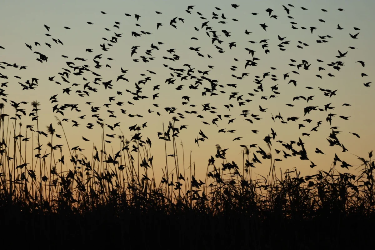
As the sun dips below the horizon and the world settles into the quiet of evening, a colossal biological phenomenon unfolds in the skies above North America. While the atmosphere may appear empty to the human eye, it is currently teeming with millions of migratory birds navigating a complex aerial highway toward their wintering grounds. This annual movement, which spans from mid-August through mid-November, represents one of the most critical cycles in the natural world, dictated by biological imperatives, meteorological conditions, and ancient evolutionary navigation.
The scale of this migration is difficult to visualize, yet modern technology has allowed scientists to pull back the curtain on this nocturnal spectacle. According to data provided by BirdCast—a collaborative project involving the Cornell Lab of Ornithology, Colorado State University, and the University of Massachusetts Amherst—more than 80% of migratory bird species in North America undertake their journeys under the cover of darkness. By utilizing a network of weather surveillance radar systems, researchers are now capable of tracking these movements in real-time, offering unprecedented insight into the timing, trajectory, and density of avian traffic.
The Mechanics of Nocturnal Movement
The decision to migrate at night is not accidental; it is a sophisticated survival strategy honed over millennia. Flying at night offers birds several distinct advantages. First, the cooler nighttime temperatures help mitigate the risk of overheating during the strenuous physical exertion of sustained flight. Furthermore, the atmosphere is generally more stable after sunset, with less convective turbulence compared to the heat-driven instability of daylight hours.
Perhaps most importantly, many species have evolved to harness favorable winds found at higher altitudes during the night. By aligning their travel with these atmospheric currents, birds can achieve greater speeds and cover longer distances while conserving precious energy stores—a necessity for species that may fly for hundreds of miles without stopping.
For the casual observer, however, this phenomenon remains largely invisible. The birds fly at altitudes ranging from a few hundred to several thousand feet, rendering them silent and unseen. This "ghost migration" is only brought into focus through the lens of meteorology. Weather radar, designed to detect precipitation, also identifies the biological signatures of birds, bats, and insects as they pass through the beam. By filtering out rain and snow, scientists can isolate the movement of avian clusters, providing a live, bird’s-eye view of the continent’s seasonal shifts.
A Chronology of the Fall Journey
The fall migration is a highly dynamic process that begins in earnest in mid-August, as birds that bred in the northern reaches of Canada and the United States begin their trek toward the southern United States, Mexico, the Caribbean, and Central and South America. The intensity of this migration is not uniform; it is a rhythmic, pulse-like event that fluctuates based on local weather fronts.

Historically, the migration reaches its peak in various regions between September and October. The timing is influenced by day length, which triggers the physiological instinct to migrate, but the daily progression is dictated by the weather. A strong cold front from the north, for instance, can act as a catalyst, signaling to thousands of birds that it is time to depart. Conversely, stormy weather or strong headwinds can force birds to pause their journey, creating "stopover" events where local bird populations swell overnight as travelers seek food and shelter before continuing south.
In September 2025, the power of these environmental drivers was on full display. BirdCast recorded a historic movement in which an estimated 1.2 billion birds took to the skies over a single night. This event, which marked the highest single-night total since the project began formal tracking in 2018, underscored the sheer magnitude of the biological machinery currently operating above our heads.
Navigating the Flyways
North America is crisscrossed by four primary migration routes, known as flyways: the Atlantic, Mississippi, Central, and Pacific. These pathways act as corridors of connectivity, linking breeding habitats in the north to wintering grounds in the tropics and subtropics.
- The Atlantic Flyway: Stretching along the eastern seaboard, this route is heavily utilized by shorebirds and songbirds moving toward the Caribbean and South America.
- The Mississippi Flyway: Following the course of the Mississippi River, this route serves as a major funnel for birds moving through the heart of the continent.
- The Central Flyway: Traversing the Great Plains, this corridor is essential for species moving from the northern prairies to the Gulf Coast and beyond.
- The Pacific Flyway: Running along the western edge of the continent, this route is critical for species navigating the complex topography of the Rocky Mountains and the Pacific coastline.
The density of bird traffic varies significantly depending on one’s proximity to these corridors. A birdwatcher in the Mississippi Flyway, for example, may see a vastly different level of nocturnal activity on the BirdCast dashboard than someone situated in the arid regions of the interior west.
Technological Breakthroughs in Species Identification
For years, the limitation of radar technology was that it could detect "that" birds were flying, but not "which" birds were flying. A radar return might indicate a massive cluster of biomass, but it offered no insight into whether those birds were warblers, thrushes, or sparrows.
That changed significantly in 2026. A multidisciplinary team of researchers from the Cornell Lab of Ornithology, the University of Massachusetts Amherst, and the University of Illinois pioneered new modeling techniques to bridge this gap. By synthesizing real-time radar data with over 2 billion observations submitted by citizen scientists via the eBird platform, the team developed the "BirdFlow Migration Traffic Rate" model.
This model is a game-changer for ornithology. It allows scientists to generate species-specific estimates of migration, providing weekly updates on the expected movement of individual populations across the continent. This shift from general tracking to species-specific analysis offers profound implications for conservation. By knowing exactly when and where certain species are likely to pass through a specific county, researchers can better advise on conservation measures, such as the temporary dimming of city lights during peak migration nights to prevent light pollution from disorienting birds.

The Broader Impact and Environmental Implications
The nocturnal migration is not merely a spectacle of nature; it is a vital ecological service. Migratory birds play essential roles in pollination, seed dispersal, and pest control across the entire hemisphere. The massive scale of this movement highlights the vulnerability of these species to environmental changes.
Habitat loss, climate change, and the increasing frequency of extreme weather events pose significant risks to migratory success. When birds arrive at a stopover site exhausted from a long flight, they rely on the availability of high-quality habitat to refuel. If that habitat has been replaced by urban development or depleted by drought, the birds’ ability to complete the remainder of their journey is severely compromised.
Furthermore, light pollution has been identified as a major disruptor of nocturnal migration. Artificial light at night (ALAN) can lure birds into urban environments, where they are at higher risk of building collisions and other hazards. Projects like BirdCast serve as a critical tool for public awareness, as they empower municipalities and individuals to take actionable steps—such as "Lights Out" programs—during nights of peak migration.
A Call to Engagement
For the public, the ability to access this data provides a unique opportunity to connect with the natural world in a way that was impossible just a decade ago. The BirdCast Migration Dashboard, which allows users to view activity at the county level, translates complex scientific data into actionable information. By checking the forecast, residents can predict when to expect high numbers of birds in their area and, in turn, contribute to the broader effort of avian conservation.
As the 2026 fall migration continues to unfold, the skies will remain busy with millions of tiny travelers. Whether it is a warbler pushing through a cool autumn night or a shorebird navigating the coastline, these creatures are participating in an ancient, vital, and increasingly understood journey. For those standing on the ground, the knowledge that such a massive, silent, and essential operation is occurring just above our heads serves as a reminder of the intricate, interconnected nature of the planet’s ecosystems. By combining the power of citizen science with advanced radar technology, humanity is finally gaining the ability to appreciate—and protect—one of nature’s most remarkable achievements.

